The GeoThinking Lens on Multimodal Geospatial Foundation Models and Agentic Spatial Reasoning
What if the next major breakthrough in geospatial intelligence is not an AI model that detects more features, but a system that knows what evidence to investigate next—and when it has enough evidence to support a decision?
For decades, geospatial technology has helped us observe the physical world.
Satellites capture changes. Drones document infrastructure. GIS organizes spatial relationships. Machine learning identifies patterns that would otherwise require extensive manual interpretation.
Yet something important remains missing.
Detecting a change is not the same as understanding its significance.
A satellite may identify disturbed ground near a highway. A computer vision model may classify the disturbance as exposed soil. A GIS overlay may reveal its proximity to a drainage culvert.
But none of these observations independently establishes whether the disturbance represents agricultural activity, authorized construction, erosion, or an emerging infrastructure failure.
That determination requires context, multiple sources of evidence, and reasoning across spatial and temporal relationships.
This is where Multimodal Geospatial Foundation Models (GeoFMs) and Agentic Spatial Reasoning begin to change the conversation.
Not because machines suddenly understand the Earth as humans do.
But because we are developing systems that can move beyond isolated predictions toward coordinated investigation.
The Problem: We Built Models to Recognize Features, Not Investigate Situations
Traditional geospatial AI has largely followed a task-specific development approach.
A model detects building footprints. Another classifies crops. A third identifies flooded areas. A fourth monitors infrastructure changes.
Each model often requires its own training data, annotations, validation procedures, and maintenance.
This approach works, but it becomes expensive when geography, seasons, sensors, or operational requirements change.
Consider a model trained to recognize agricultural patterns in Europe.
Deploying it across India's fragmented agricultural landscapes may expose substantial differences in field geometry, cropping cycles, vegetation conditions, and atmospheric interference.
The model may still perform reasonably well, but its reliability cannot simply be assumed.
More importantly, even a highly accurate classification model addresses only part of an operational question.
An infrastructure operator rarely asks:
Where are the disturbed soil pixels?
The actual question is:
Which disturbances threaten our assets, why do they matter, and what should we investigate first?
That difference reveals the limitation of treating geospatial intelligence primarily as an image classification problem.
The real operational challenge is not recognizing everything. It is determining what matters.
The Shift: From Task-Specific Models to Reusable Earth Representations
Geospatial Foundation Models introduce a different development approach.
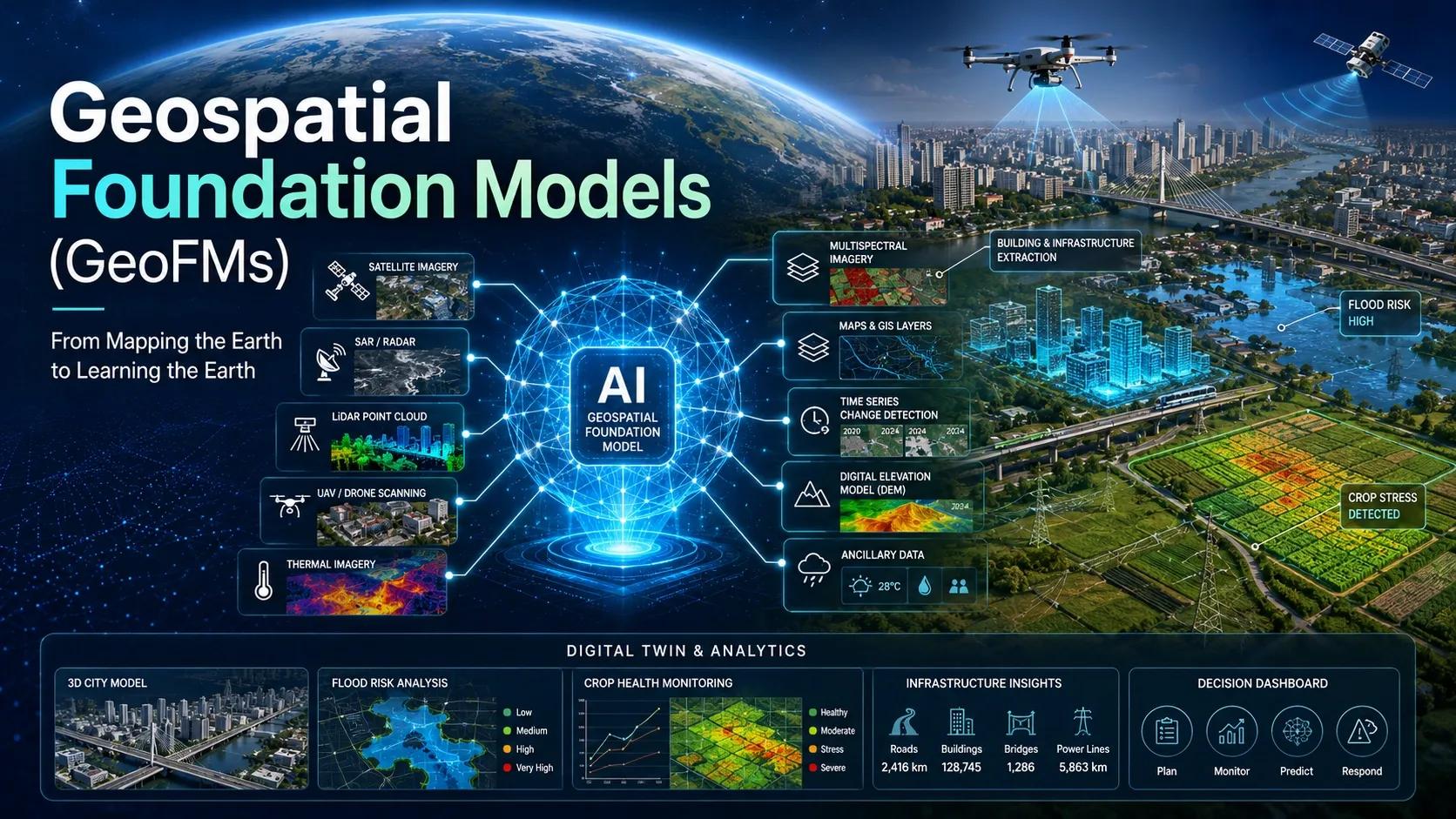
Instead of training a model from scratch for every application, researchers pre-train large models on extensive Earth observation datasets.
Using techniques such as self-supervised learning, these models learn useful representations from imagery without requiring every feature to be manually labeled.
For example, NASA and IBM's Prithvi-EO-2.0 uses multi-temporal satellite imagery to learn representations of Earth's surface across different locations and observation dates.
Its 300-million- and 600-million-parameter versions were developed using millions of training samples from Harmonized Landsat and Sentinel-2 observations.
These representations can then be adapted for applications such as flood mapping, land classification, and environmental monitoring.
The Clay Foundation Model offers another approach, supporting different imagery sources, including optical and radar observations, through its sensor-aware architecture.
The significance extends beyond reducing training effort.
Different sensors reveal different properties of the same physical environment.
Optical imagery captures reflectance and vegetation characteristics. Synthetic Aperture Radar (SAR) provides microwave observations under cloud cover. Elevation models describe terrain geometry. Weather observations add environmental context.
However, supporting multiple sensors does not automatically mean every foundation model can jointly reason across all these modalities. The fusion architecture, training data, and downstream validation still matter.
The opportunity is to bring these observations into a common analytical workflow.
We are moving from asking individual models what they can recognize toward asking a system what the available observations collectively suggest.
India is also developing capabilities in this direction. In June 2026, Bengaluru-based SatSure announced Dhaarini, a sovereign Earth-intelligence initiative supported by ₹24.6 crore in funding from IN-SPACe. It aims to develop foundation models and reusable geospatial representations suited to Indian landscapes, seasonal patterns, and operational requirements.
Meanwhile, ISRO's Space Applications Centre has identified foundation models trained on Indian satellite datasets as a research priority. Companies such as Pixxel and GalaxEye are expanding the country's hyperspectral and multisensor observation capabilities.
These initiatives represent different stages of development, but collectively they point toward an important transition: India is building not only the capacity to observe the Earth, but also the foundations for interpreting those observations through reusable AI systems.
The Real Transition: From Perception to Spatial Reasoning
A foundation model can extract features, generate embeddings, or identify changes.
But operational intelligence requires additional steps.
It must establish where the change occurred, when it occurred, which assets are affected, what alternative explanations exist, and whether the available evidence supports intervention.
This introduces Agentic Spatial Reasoning.
An AI agent can interpret an operational objective, select appropriate geospatial tools, retrieve observations, execute analytical workflows, and assemble the resulting evidence.
Imagine an infrastructure manager asking:
“Identify potential risks along our 300-kilometre water transmission corridor following yesterday's heavy rainfall.”
An agentic workflow could:
- Retrieve recent optical and SAR observations through geospatial data services.
- Compare observations against historical surface conditions.
- Identify candidate changes near the transmission corridor.
- Intersect detected changes with the asset network, terrain, and drainage layers.
- Incorporate rainfall records and known maintenance activities.
- Prioritize locations requiring further inspection.
The important distinction is that the agent is not simply generating a map.
It is coordinating an investigation.
Recent developments make this direction more tangible. In October 2026, Google Research described an experimental Geospatial Reasoning agent that combines Earth AI models, spatial tools, and explicit planning to perform multi-step analysis.
Its researchers also emphasized that agent outputs should be treated as drafts for expert review, not automatically accepted as final conclusions.
This distinction matters.
An AI system that can execute spatial workflows is not necessarily an AI system that can reliably authorize physical-world decisions.
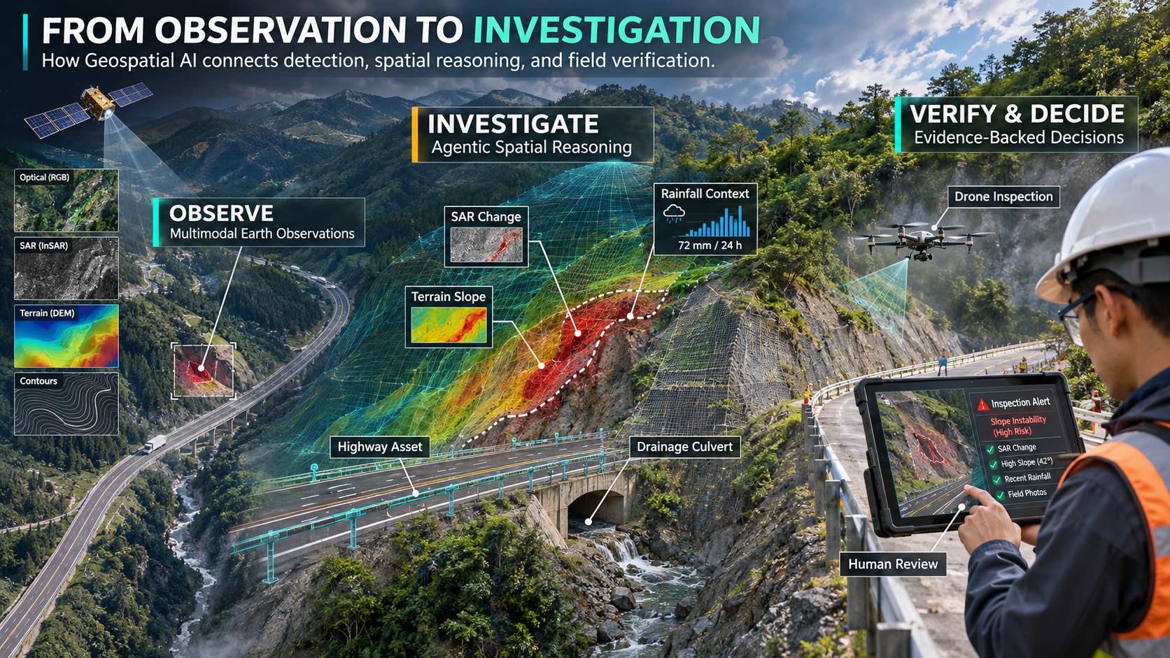
A Practical Scenario: When a Highway Embankment Changes
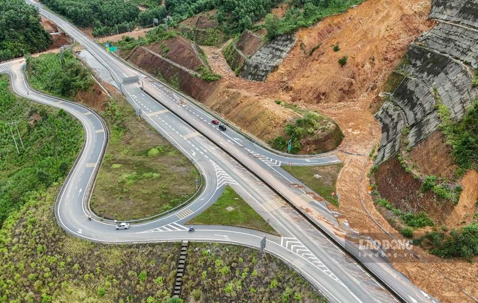
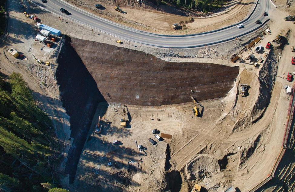
Consider a highway corridor running through terrain vulnerable to monsoon-induced slope instability.
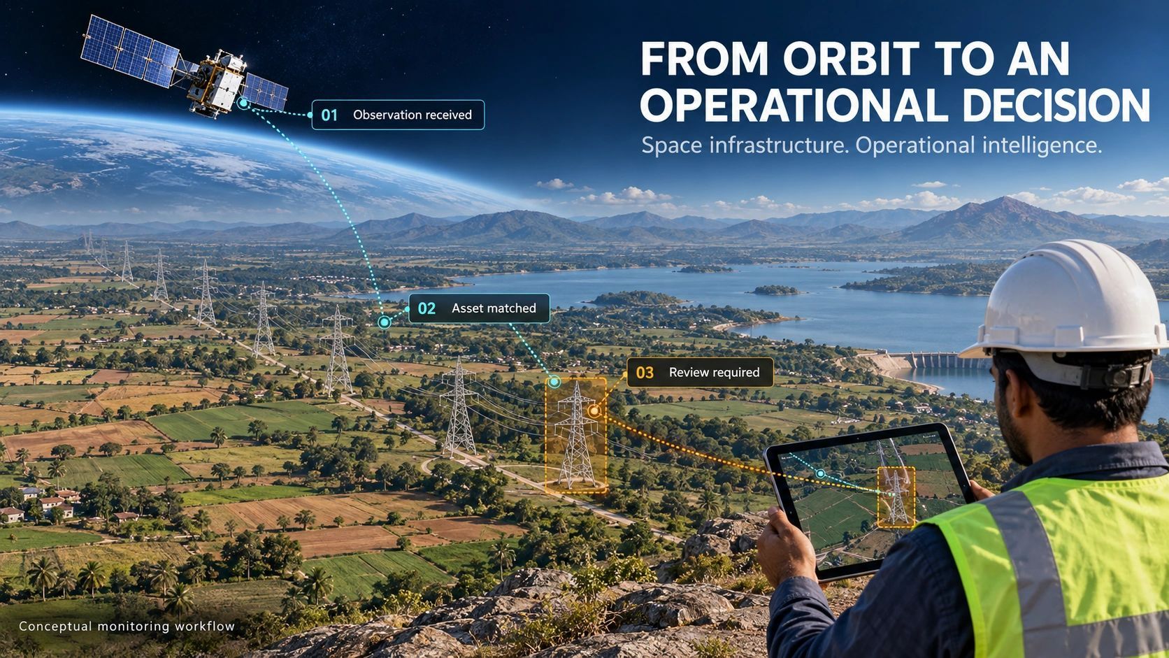
Satellite observations identify an unusual change on an embankment above a drainage culvert.
A conventional workflow might produce a change-detection polygon and send it to an analyst.
An agentic workflow could investigate further.
This is an illustrative operational workflow, not a claim that a single production system already performs every stage autonomously.
Notice what has changed.
The satellite observation is no longer the final product.
It becomes the beginning of an evidence-gathering process.
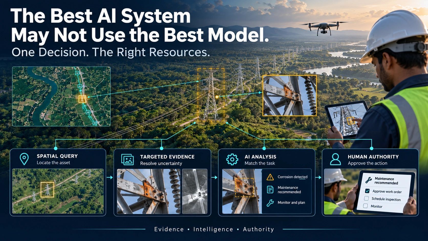
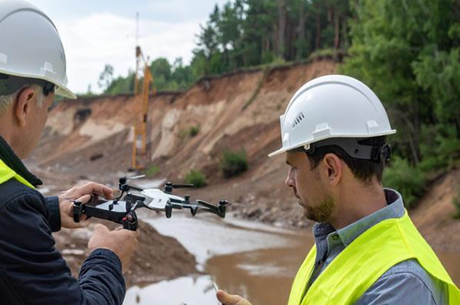
And the drone is not deployed simply because an anomaly exists. It is deployed because a specific uncertainty needs resolving.
That is a more useful role for AI: helping determine the next justified observation.
The Missing Layer: Evidence, Uncertainty, and Authority
There is a significant risk in moving too quickly from automated detection to automated decisions.
An agent may successfully retrieve data, execute spatial analysis, and generate a convincing explanation.
Yet the underlying evidence may be outdated, incomplete, incorrectly registered, or unsuitable for the decision.
A SAR anomaly does not independently prove a landslide.
A model's confidence score does not establish that two observations are independent.
And a well-structured inspection recommendation does not itself constitute permission to initiate physical work.
A trustworthy agentic system must therefore answer several questions:
- Evidence: Which observations support the conclusion?
- Freshness: Are those observations recent enough for the operational decision?
- Uncertainty: What remains unresolved or contradictory?
- Provenance: Which datasets, model versions, and processing steps produced the result?
- Authority: Who is permitted to approve the recommended action?
These are not secondary governance considerations.
They determine whether geospatial AI can be trusted beyond the analytical environment.
The system should also recognize when the evidence is insufficient and recommend another observation rather than manufacture certainty.
The next frontier is not autonomous analysis alone. It is evidence-aware autonomy with clearly defined limits.
What Is Ready Today and What Remains Experimental?
The technology is advancing, but its components are not equally mature.
Geospatial foundation models already provide practical capabilities for feature extraction, classification, segmentation, and change analysis, although performance depends on the task and local validation.
Spatial agents can increasingly orchestrate data retrieval, GIS operations, and model inference.
However, reliable end-to-end reasoning across complex physical situations remains an emerging capability.
Resolution differences, computational requirements, sensor registration, geographic generalization, and validation continue to impose constraints.
A model trained primarily on medium-resolution imagery should not automatically be trusted to identify sub-meter infrastructure defects.
Similarly, an agent that correctly executes ten analytical steps may still reach a flawed conclusion if its assumptions are wrong.
Successful deployment therefore requires more than selecting a foundation model.
It requires a carefully designed operational system connecting observation, spatial context, evidence assessment, human review, and subsequent verification.
The GeoThinking Perspective: Intelligence Is Becoming an Investigative Process
For years, the geospatial industry has competed on how accurately and efficiently it can map the world.
We improved spatial resolution, increased acquisition frequency, expanded sensor coverage, and automated feature extraction.
Those advances remain essential.
But the next source of value may emerge from how intelligently these capabilities are coordinated.
A geospatial foundation model provides reusable representations.
An agent provides workflow orchestration.
GIS supplies location, topology, and asset relationships.
Digital twins provide operational context.
Evidence governance establishes what conclusions and actions the available information can justify.
Together, these capabilities point toward a different relationship with the physical world.
Not a system that simply tells us what changed.
But one that helps investigate why it changed, what may be affected, what remains uncertain, and which observation or intervention should follow.
And perhaps the most important capability will be knowing when not to conclude.
The future of geospatial intelligence may not be a machine that knows everything about a place. It may be a system that knows what it must establish before recommending what happens there.