A crop survey can produce an accurate-looking map and still leave an important question unanswered:
Why was this crop accepted for this particular plot?
That question matters when a crop record informs agricultural planning, public services or a farmer’s access to a scheme. If the record is challenged, an official needs more than a colored polygon and a model output. They need to see when the crop was observed, what evidence was available, where uncertainty remained and who accepted the final record.
Karnataka’s proposed Composite Digital Crop Survey pilot offers a useful example of how this challenge is evolving.
The published tender listing for Kota Hobli includes satellite imagery over four seasons, six acquisitions per year for three years, ground truthing, and annual drone surveys during Kharif. It also includes SAR and hyperspectral data where required. This is a proposed pilot procurement, not evidence that the programme has already delivered these results.
The design points towards a more useful way to think about crop surveys: as a continuing process of collecting, comparing and reviewing evidence about each plot.
The map is the beginning of the question
Consider an illustrative example.
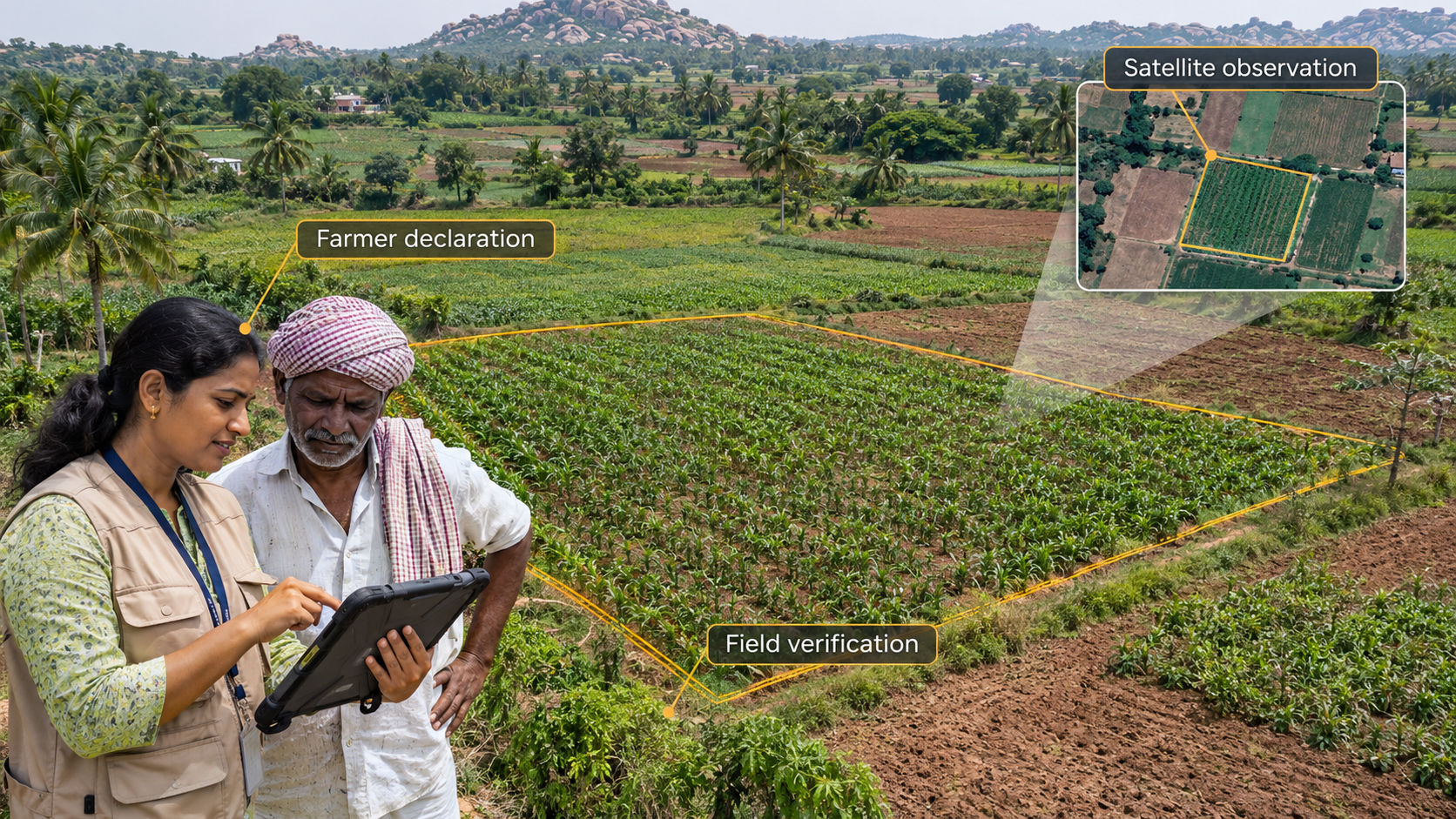
A farmer declares that a small plot contains maize. A satellite classification suggests cotton. A drone image collected several weeks later shows a crop, but its growth stage makes visual identification uncertain.
Which result should become the accepted crop record?
A simple workflow might select the model’s highest-scoring class. Another might send every disagreement for a field visit. Both can create problems.
The first risks turning an uncertain prediction into an official record. The second can make the programme slow and expensive, particularly when thousands of plots require attention during a short seasonal window.
The better question is:
What additional evidence would be most useful for resolving this particular disagreement?
The answer may be a more recent satellite observation, a review of the parcel boundary, a targeted field visit or a conversation with the farmer. It may also be that the available information cannot resolve the case in time and the record should remain pending.
More sensors do not automatically settle a disagreement
Different observations contribute different strengths.
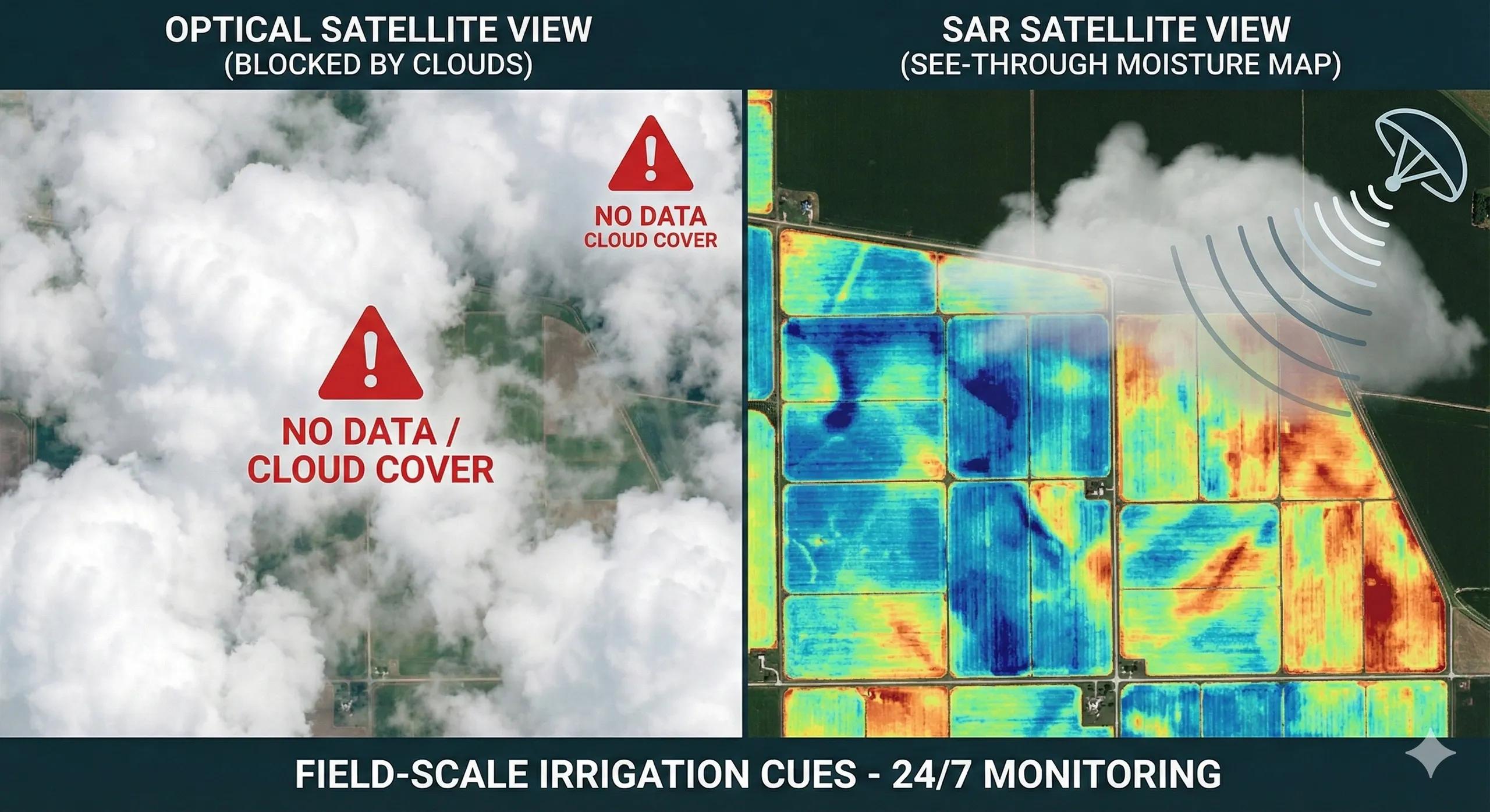
Optical satellite imagery can show crop development over time, but cloud cover may limit usable observations. SAR can provide observations under cloudy conditions, although its interpretation depends on crop type, growth stage, moisture and other factors. Drone imagery can offer more local detail, but collecting and analyzing it across every plot may be costly.
Field observations can add context that imagery cannot easily provide. Yet they also need to be linked to the right plot, recorded at the right time and reviewed for quality.
There is another complication: two observations that appear to agree may share the same error. Satellite and drone imagery could, for example, both be matched to an incorrect parcel boundary. Agreement between their outputs would not necessarily resolve that underlying problem.
The goal, therefore, is not simply to collect more data. It is to understand what each source can establish, what it cannot establish and which assumptions it shares with other sources.
A plot needs an evidence record
Most crop maps show the conclusion. A decision-ready crop survey should also retain the path to that conclusion.
I would structure a Plot Evidence Record around five questions:
1. Which plot and season are being assessed?
The record should identify the parcel, its boundary version and the relevant season or observation period.
This is essential because a crop finding is tied to both location and time. A record accepted for one season should not automatically be treated as current for the next.
2. What was reported and observed?
The record should distinguish the farmer’s declaration from satellite observations, drone imagery and field reports. Each item should carry its date, source and relevant processing information.
A farmer’s declaration and a model prediction are different kinds of information. Preserving that distinction makes disagreements visible rather than hiding them inside one final label.
3. What did the model conclude and how reliable is that conclusion?
The system should retain the predicted crop, other plausible classes where available, and the model version used.
A confidence score can help prioritize review, but it needs to be tested against local crops, seasons and field conditions before it is used as a decision threshold. A high score alone does not prove that a particular plot is correct.
4. What happened when the evidence conflicted?
The record should show whether the disagreement triggered a boundary check, a new observation, field verification or human review.
If the evidence remained inconclusive, that status should be visible. “Pending verification” is a useful operational outcome when the alternative is an unsupported decision.
5. Who accepted or corrected the record?
The final record should identify the authorized reviewer, the decision date and the reason for acceptance or correction. Where applicable, it should preserve the process for a farmer to raise a concern and for the record to be reviewed.
This is a proposed approach to designing a defensible workflow. The published tender summary confirms the survey inputs and pilot scope; it does not establish that all these record and review features are required or already implemented.
Verification should be targeted, not automatic
Field teams are a limited resource. Their time should be directed towards the plots where an additional observation can make the greatest difference.
A practical prioritization approach could consider:
- Uncertainty: Is the model unable to distinguish between plausible crops?
- Disagreement: Does the declaration conflict with the available observations?
- Consequence: Would an incorrect record materially affect a decision or service?
- Timing: Can the crop still be verified during the current growth stage?
- Shared errors: Could a boundary, location or processing issue explain the conflict?
The last point matters. Sending a drone to collect sharper imagery may not help if the real problem is an incorrect parcel boundary. The next action should address the likely source of uncertainty.
Not every unresolved plot will justify the same level of effort. A programme needs clear rules for when to accept, when to review and when to leave a record unresolved until better evidence is available.
The record must survive changes in the model
A three-year survey creates another challenge: the model used in the first season may not be the model used in the third.
New training data, revised crop classes or improved processing can change later predictions. That may improve future records, but it should not silently rewrite the basis of an earlier decision.
A well-managed system should preserve the original observation, model version, accepted record and any later correction. If an old record is reassessed, users should be able to see what changed and why.
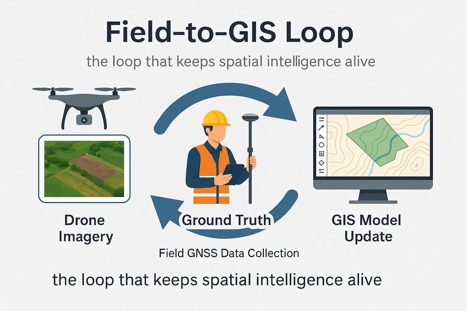
This is also where geospatial systems, field applications and AI workflows need to work together. Interoperability is not just about displaying all layers on one map. It is about retaining the relationship between the plot, the observation, the prediction and the person responsible for the decision.
Measure the survey by the decisions it supports
Model accuracy remains important. But a programme should also ask:
- How many disputed plots were resolved within the season?
- How many records required correction after acceptance?
- How long did verification take?
- What did field verification cost per resolved case?
- Can a reviewer reconstruct the basis of an accepted crop record?
These measures connect technical performance to service quality, cost and accountability.
The next step in digital crop surveys is not simply a more detailed crop map. It is a record that can explain its conclusion, acknowledge uncertainty and make correction possible.
A crop label tells us what the system believes. The evidence record tells us whether that belief is ready to support a decision.